⚠️ WEATHER ALERT · WEATHER
Alert for the "deluge of the year": severe storms, gusts of up to 100 km/h and a polar cold wave hit Argentina
The National Meteorological Service maintains a yellow alert in force for this Monday, August 31, which includes hail, strong gusts of wind, electrical activity and risk of flooding in six provinces of the country.
|
📅 Publication date
|
August 31, 2026
|
|
⏱️ Reading Time
|
Approx. 4 minutes (≈ 780 words)
|
|
🗂️ Category
|
General Information / Climate
|
|
📍 Coverage
|
Formosa, Corrientes, Misiones, San Luis, Córdoba and La Rioja
|
|
🏷️ SEO keywords
|
weather alert Argentina, storms August 31, SMN yellow alert, hail, polar cold wave
|
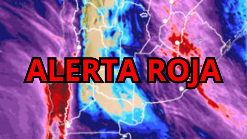
Image source: Meteored / Composition in Canva, via El Cronista.
Argentina started the last week of August under a scenario of strong atmospheric instability. The National Meteorological Service (SMN) has maintained a yellow alert since early Monday morning for strong storms that, according to the agency, could lead to what is already colloquially described as "the deluge of the year". The combination of intense rains in short periods, wind gusts that would reach 100 km/h, hail and a subsequent thermal drop due to the entry of polar air configures a panorama that requires special attention in at least six provinces.
The phenomenon is part of the advance of a frontal system of great development, which specialists link to a cyclogenesis process of up to 48 hours duration. While the center and north of the country remain on alert, the Metropolitan Area of Buenos Aires (AMBA) is not, for the moment, among the areas of severe risk.
🌩️ Six provinces under yellow alert for strong storms
According to the latest report from the SMN, the most unstable conditions of the day are concentrated in Formosa, Corrientes, Misiones, San Luis, Córdoba and La Rioja. In these jurisdictions, some storms could intensify quickly and discharge large volumes of water in very short periods of time, accompanied by frequent electrical activity and hail in a timely manner.
• Formosa, Corrientes and Misiones: greater probability of strong storms and abundant rains.
• San Luis, Córdoba and La Rioja: episodes of severe weather of isolated development but rapid intensification.
☔ Flood risk: how much water could fall
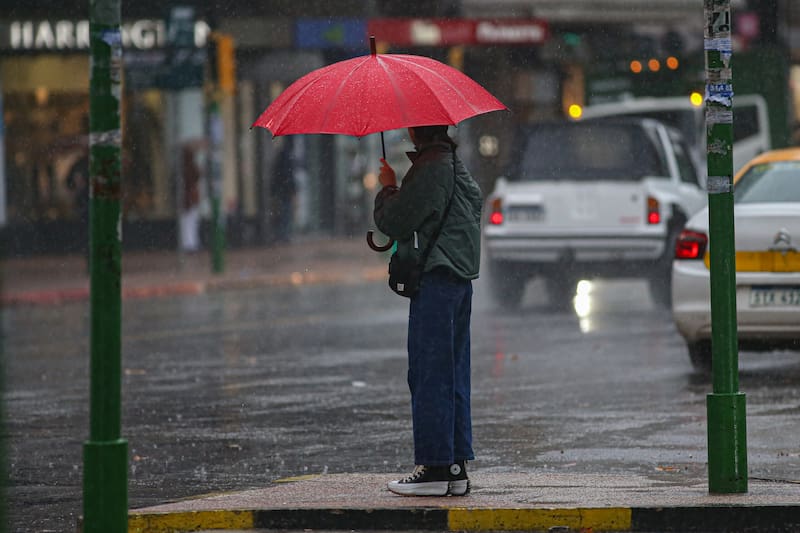
Photo: Foco Uy, via El Cronista.
One of the sources of concern is the volume of water that can accumulate in a short time. Official projections place the accumulated between 20 and 50 millimeters, although it is not ruled out that this threshold will be exceeded occasionally in certain localities. This type of discharge can result in temporary flooding in streets, routes and urban or peri-urban sectors with drainage problems, so it is recommended to avoid driving in areas with water accumulation.
💨 Gusts, lightning and hail: the phenomena that are of most concern
Beyond rain, the risk combo includes intense wind gusts – which in some areas could approach or exceed 90-100 km/h – frequent lightning and hail. Each of these phenomena represents a different threat: the wind can detach branches, signs and light structures; lightning poses a direct risk to those left outdoors; and hail can damage vehicles, roofs and crops when storm cells gain intensity.
❄️ After the storm, the cold arrives: polar air enters
The SMN anticipates that, after the passage of the front, a polar air mass will enter that will cause a marked thermal drop. In Misiones, one of the most compromised provinces, the minimums would range between 15°C and 18°C this Monday, with an additional drop expected for Tuesday. This thermal contrast – heat and humidity before the storm, dry cold afterwards – is common in cold fronts at the end of winter and usually coincides with the moment of greatest instability.
In contrast, the AMBA will go through the day without alerts for severe phenomena, with partly cloudy skies, minimums close to 11°C, maximums around 19°C and moderate winds from the east and southeast.
✅ Official recommendations in the face of the yellow alert
Faced with this scenario, the authorities and the SMN itself recommend taking extreme precautions. Among the main preventive measures are:
• Avoid going out during the development of storms, unless strictly necessary.
• Do not drive on flooded streets, routes or roads.
• Clean drains and drains, and do not take garbage out on public roads.
• Check roofs, gutters and balconies before the wind picks up.
• Secure or remove light objects (flower pots, awnings, garden chairs) that can be displaced by the wind.
• Avoid taking shelter under trees, poles, canopies or unstable signs.
• Disconnect appliances if there is a risk of water ingress.
• Stay informed through official channels and updates from the SMN.
📌 What does the yellow alert mean?
The yellow alert is the first step of the National Meteorological Service's warning system and warns of phenomena with the capacity to generate inconveniences in daily activities and certain specific risks for the population, without yet reaching the level of danger of the orange or red alerts. Its validity can be updated as the frontal system evolves, so it is recommended to closely follow the weather reports during the rest of the day.
🔎 Sources consulted
🔗 El Cronista — The deluge of the year is approaching on Monday, August 31: hailstorms, strong gusts of wind and risk of flooding in these six provinces of Argentina
🔗 El Cronista — The deluge of the year is approaching on Monday, August 31: hailstorms, strong wind gusts of 70 km/h and a polar cold wave in this province
🎯 SEO Data Sheet
Elements optimized for positioning in search engines and AI assistants (AEO/GEO), ready to be dumped in the CMS.
🏷️ Meta title (≤60 characters)
→ Alert for the "deluge of the year": storms and polar cold in Argentina
📝 Meta description (≤155 characters)
→ SMN issues a yellow alert for storms, hail and gusts of up to 100 km/h in 6 provinces, followed by a polar cold wave. Recommendations.
🔑 Primary and secondary keywords
• Main: weather alert Argentina August 31
• Secondary: hailstorms, wind gusts 100 km/h, yellow alert SMN, polar cold wave, floods Argentina
🌐 Suggested friendly URL
→ /climate/alert-deluge-of-the-year-storms-cold-polar-hail-argentina
🗺️ Hn structure (semantic hierarchy)
• H1: main title of the news (only once)
• H2: thematic blocks (provinces, floods, wind/hail, polar cold, recommendations)
• H3: subtopics and sources, with natural long-tail keywords
🧠 Recommended structured data (Schema.org)
• NewsArticle: headline, datePublished, dateModified, author, image, articleSection.
• FAQPage: frequently asked questions ("Which provinces are on alert?", "How much can it rain?") to enrich generative AI (GEO) results and responses.
• BreadcrumbList: Home > Weather > Weather Alert.
⚡ Technical and Experience Optimization
• Images with descriptive alt attribute ("Argentina storm alert August 31") and lazy-loading.
• Internal links to related climate notes and to specific provincial coverage.
• Outbound links to official sources (SMN) to reinforce the authority signal (E-E-A-T).
• "Above the fold" content with direct response (provinces, time, risk) for featured snippets.
• Date update (dateModified) if the alert is extended or changes level, for a sign of freshness.
❓ Suggested FAQs (for FAQs)
• Which Argentine provinces are on alert for storms today? → Formosa, Corrientes, Misiones, San Luis, Córdoba and La Rioja.
• How much wind is expected? → Gusts that could approach 90-100 km/h in the most affected areas.
• Will it be cold after the storm? → Yes, a polar air mass enters with a marked thermal drop.
Read more...
⚠️ WEATHER ALERT · WEATHER
Alert for the "deluge of the year": severe storms, gusts of up to 100 km/h and a polar cold wave hit Argentina
The National Meteorological Service maintains a yellow alert in force for this Monday, August 31, which includes hail, strong gusts of wind, electrical activity and risk of flooding in six provinces of the country.
|
📅 Publication date
|
August 31, 2026
|
|
⏱️ Reading Time
|
Approx. 4 minutes (≈ 780 words)
|
|
🗂️ Category
|
General Information / Climate
|
|
📍 Coverage
|
Formosa, Corrientes, Misiones, San Luis, Córdoba and La Rioja
|
|
🏷️ SEO keywords
|
weather alert Argentina, storms August 31, SMN yellow alert, hail, polar cold wave
|
Image source: Meteored / Composition in Canva, via El Cronista.
Argentina started the last week of August under a scenario of strong atmospheric instability. The National Meteorological Service (SMN) has maintained a yellow alert since early Monday morning for strong storms that, according to the agency, could lead to what is already colloquially described as "the deluge of the year". The combination of intense rains in short periods, wind gusts that would reach 100 km/h, hail and a subsequent thermal drop due to the entry of polar air configures a panorama that requires special attention in at least six provinces.
The phenomenon is part of the advance of a frontal system of great development, which specialists link to a cyclogenesis process of up to 48 hours duration. While the center and north of the country remain on alert, the Metropolitan Area of Buenos Aires (AMBA) is not, for the moment, among the areas of severe risk.
🌩️ Six provinces under yellow alert for strong storms
According to the latest report from the SMN, the most unstable conditions of the day are concentrated in Formosa, Corrientes, Misiones, San Luis, Córdoba and La Rioja. In these jurisdictions, some storms could intensify quickly and discharge large volumes of water in very short periods of time, accompanied by frequent electrical activity and hail in a timely manner.
• Formosa, Corrientes and Misiones: greater probability of strong storms and abundant rains.
• San Luis, Córdoba and La Rioja: episodes of severe weather of isolated development but rapid intensification.
☔ Flood risk: how much water could fall
Photo: Foco Uy, via El Cronista.
One of the sources of concern is the volume of water that can accumulate in a short time. Official projections place the accumulated between 20 and 50 millimeters, although it is not ruled out that this threshold will be exceeded occasionally in certain localities. This type of discharge can result in temporary flooding in streets, routes and urban or peri-urban sectors with drainage problems, so it is recommended to avoid driving in areas with water accumulation.
💨 Gusts, lightning and hail: the phenomena that are of most concern
Beyond rain, the risk combo includes intense wind gusts – which in some areas could approach or exceed 90-100 km/h – frequent lightning and hail. Each of these phenomena represents a different threat: the wind can detach branches, signs and light structures; lightning poses a direct risk to those left outdoors; and hail can damage vehicles, roofs and crops when storm cells gain intensity.
❄️ After the storm, the cold arrives: polar air enters
The SMN anticipates that, after the passage of the front, a polar air mass will enter that will cause a marked thermal drop. In Misiones, one of the most compromised provinces, the minimums would range between 15°C and 18°C this Monday, with an additional drop expected for Tuesday. This thermal contrast – heat and humidity before the storm, dry cold afterwards – is common in cold fronts at the end of winter and usually coincides with the moment of greatest instability.
In contrast, the AMBA will go through the day without alerts for severe phenomena, with partly cloudy skies, minimums close to 11°C, maximums around 19°C and moderate winds from the east and southeast.
✅ Official recommendations in the face of the yellow alert
Faced with this scenario, the authorities and the SMN itself recommend taking extreme precautions. Among the main preventive measures are:
• Avoid going out during the development of storms, unless strictly necessary.
• Do not drive on flooded streets, routes or roads.
• Clean drains and drains, and do not take garbage out on public roads.
• Check roofs, gutters and balconies before the wind picks up.
• Secure or remove light objects (flower pots, awnings, garden chairs) that can be displaced by the wind.
• Avoid taking shelter under trees, poles, canopies or unstable signs.
• Disconnect appliances if there is a risk of water ingress.
• Stay informed through official channels and updates from the SMN.
📌 What does the yellow alert mean?
The yellow alert is the first step of the National Meteorological Service's warning system and warns of phenomena with the capacity to generate inconveniences in daily activities and certain specific risks for the population, without yet reaching the level of danger of the orange or red alerts. Its validity can be updated as the frontal system evolves, so it is recommended to closely follow the weather reports during the rest of the day.
🔎 Sources consulted
🔗 El Cronista — The deluge of the year is approaching on Monday, August 31: hailstorms, strong gusts of wind and risk of flooding in these six provinces of Argentina
🔗 El Cronista — The deluge of the year is approaching on Monday, August 31: hailstorms, strong wind gusts of 70 km/h and a polar cold wave in this province
🎯 SEO Data Sheet
Elements optimized for positioning in search engines and AI assistants (AEO/GEO), ready to be dumped in the CMS.
🏷️ Meta title (≤60 characters)
→ Alert for the "deluge of the year": storms and polar cold in Argentina
📝 Meta description (≤155 characters)
→ SMN issues a yellow alert for storms, hail and gusts of up to 100 km/h in 6 provinces, followed by a polar cold wave. Recommendations.
🔑 Primary and secondary keywords
• Main: weather alert Argentina August 31
• Secondary: hailstorms, wind gusts 100 km/h, yellow alert SMN, polar cold wave, floods Argentina
🌐 Suggested friendly URL
→ /climate/alert-deluge-of-the-year-storms-cold-polar-hail-argentina
🗺️ Hn structure (semantic hierarchy)
• H1: main title of the news (only once)
• H2: thematic blocks (provinces, floods, wind/hail, polar cold, recommendations)
• H3: subtopics and sources, with natural long-tail keywords
🧠 Recommended structured data (Schema.org)
• NewsArticle: headline, datePublished, dateModified, author, image, articleSection.
• FAQPage: frequently asked questions ("Which provinces are on alert?", "How much can it rain?") to enrich generative AI (GEO) results and responses.
• BreadcrumbList: Home > Weather > Weather Alert.
⚡ Technical and Experience Optimization
• Images with descriptive alt attribute ("Argentina storm alert August 31") and lazy-loading.
• Internal links to related climate notes and to specific provincial coverage.
• Outbound links to official sources (SMN) to reinforce the authority signal (E-E-A-T).
• "Above the fold" content with direct response (provinces, time, risk) for featured snippets.
• Date update (dateModified) if the alert is extended or changes level, for a sign of freshness.
❓ Suggested FAQs (for FAQs)
• Which Argentine provinces are on alert for storms today? → Formosa, Corrientes, Misiones, San Luis, Córdoba and La Rioja.
• How much wind is expected? → Gusts that could approach 90-100 km/h in the most affected areas.
• Will it be cold after the storm? → Yes, a polar air mass enters with a marked thermal drop.
Close








 Alert for the "deluge of the year": severe storms, gusts of up to 100 km/h
- 31/08/2026 » 09:47 by cronywell
Alert for the "deluge of the year": severe storms, gusts of up to 100 km/h
- 31/08/2026 » 09:47 by cronywell